LBL directions can be confusing? To say the least they can. Try telling someone how to get somewhere in Land Between the Lakes or the LBL area. We have lots of visitors. Our visitors are great. However, if you don’t know the landmarks it is going to be difficult to follow some of the directions that we natives are used to giving one another.
“Well you just turn left at the old barn with the side off and go on down that way a while.”
“You mean the old red barn with the side off?”
“No, the other one, the brown one with the other side off. That one.”
“Oh, OK.”

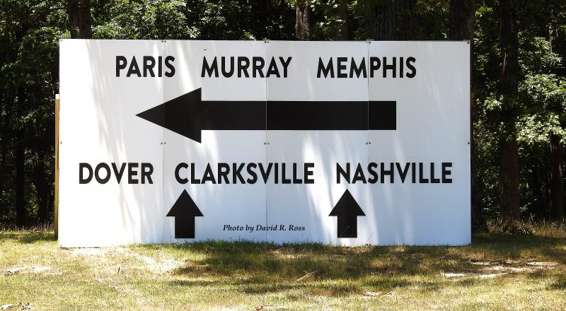
I’m sure this sign here was a big help to the folks who put it together, but I am not absolutely sure that following these directions as printed on this sign are going to get the LBL area visitor to the location he or she is seeking in Dover, Nashville, Clarksville, Paris or Memphis, Tennessee or Murray, Kentucky.
But this sign is doing a great job of listing all of the possible cool spots in the Land Between the Lakes region. It has some of the big ones covered, but it is leaving out some of the other very cool spots like Bear Spring, Indian Mound, Bumpus Mills, Big Rock, Leatherwood, and Potneck. And that is just naming the ones I can think of in Stewart County. There are many, many more.
However, there would not be enough room on the sign for all of those directions and to be frank, I am not sure there were that many folks at the gathering at Paris Landing State Park to warrant many more cities on the sign.
This sign was at Paris Landing and I think it was intended to orient the folks who were or had been attending the recent music festival on Kentucky Lake at Paris Landing.
I hope the sign helps. To me the directions seemed a bit confusing.
So what do you think? Were you able to follow the directions on this sign? If you have not yet, do you think you could. Please leave a comment. If you have a complaint, please make it brief.
Story and Photos by David R. Ross — LBLUS.com

https://www.mapquest.com/us/kentucky/land-between-the-lakes-ky-364488318

